


SityTrail - 4416686 - gorges-de-la-jonte

thonyc
User GUIDE
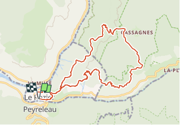

Length
11.7 km

Max alt
872 m

Uphill gradient
759 m
Km-Effort
22 km

Min alt
398 m

Downhill gradient
760 m
Boucle
Yes
Creation date :
2025-07-11 13:58:32.408
Updated on :
2025-07-14 13:20:02.0
4h57
Difficulty : Medium

FREE GPS app for hiking
 SityTrail
IGN / Geographical institutes
SityTrail Plus
The world is yours!
About
Trail Walking of 11.7 km to be discovered at Occitania, Lozère, Le Rozier. This trail is proposed by thonyc.
Positioning
Country:
France
Region :
Occitania
Department/Province :
Lozère
Municipality :
Le Rozier
Location:
Unknown
Start:(Dec)
Start:(UTM)
516599 ; 4893070 (31T) N.
Comments